Geospatial Image Visualization with PCI Geomatics
- Description
- Curriculum
- FAQ
- Reviews

This course is offered by PCI Geomatics, using Geomatica Desktop Image Processing and Analysis Software
Overview: Are you a student learning remote sensing, or does your organization make use of satellite imagery to generate image products or extract valuable information for actionable intelligence? This course will provide you with the basics on how to visualize satellite imagery and its ancillary contents.
Who is the intended audience? This course is intended for university students or professionals who are new to geographic information systems and remote sensing. After this short course you’ll be able to visualize satellite imagery using professional image processing and analysis software.
What Materials will be used? Students will be able to work with a licensed version of Geomatica as well as sample data sets to follow along with the instructor. Students are expected to install Geomatica on their computer and work with a copy of the data which is provided.
How long will it take me to complete the course? The course materials (videos) run for a little less than an hour. You will likely play the videos several times and review certain steps. The expected time to complete the course is 2-3 hours.
-
2Viewing satellite imagery in Focus
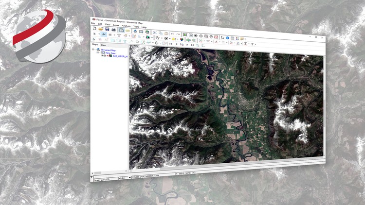
Viewing your imagery in its native format is the first step in Focus. We will use Focus within Geomatica to view our satellite imagery in its native distribution format, and view the different possible methods to opening imagery in Focus. Additionally, we will examine the different distribution formats you might encounter with satellite imagery.
-
3Imagery and the PCI data Format
To better view your images and their contents, we need to import each one of our images to the PCIDSK format. By importing our images to the PCIDSK format, we optimize the viewing of the imagery and centralize all the different files related to an image into a single file for easy handling. The benefits of using the PCIDSK format and how to import to the PCIDSK format are described in this lecture.
-
4Managing your images in Focus
There are a number of different arrangements of image bands that can be applied to produce natural and false composite RGB images. These different image compositions can be used to highlight features of interest in the landscape. In this lecture, we'll examine the different image management components in Focus and how to configure and view RGB images.


Social Network